CBSE Class 9 Geography Map Work Chapter 6 Population is part of CBSE Class 9 Social Science Map Work. Here we have given NCERT Class 9 Geography Map Work Chapter 6 Population.
| Board | CBSE |
| Textbook | NCERT |
| Class | Class 9 |
| Subject | Social Science Geography |
| Chapter | Chapter 6 |
| Chapter Name | Population |
| Number of Questions Solved | 2 |
| Category | Map Work Skills |
Class 9 Geography Map Work Chapter 6 Population
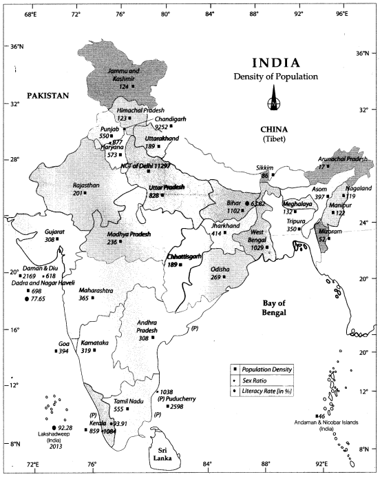
Population Density of India
In states Bihar has the highest population density, while in Union territories Delhi has the highest population density. This map shows the population density of states and Union Territories.
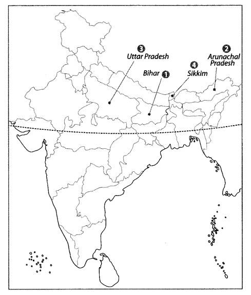
Question 1.
Locate and label the following items on the given map
1 The state having the highest population density.
2 The state having the lowest population density.
3 The most populous state of India.
4 The least populous state of India.
Answer:
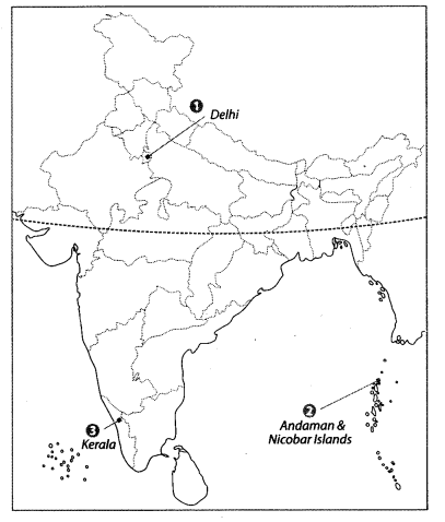
Question 2.
Features are marked by numbers in the given political map of India. Identify these features with the help of the following information and write their correct names on the lines marked in the map.
1 The Union Territory having the highest population density.
2 The Union Territory having the lowest population density.
3 The state having highest sex ratio.
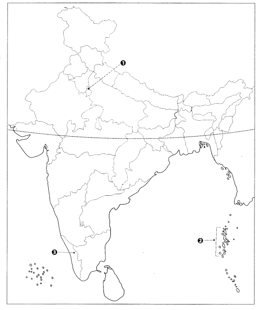
Answer:
We hope the given CBSE Class 9 Geography Map Work Chapter 6 Population will help you. If you have any query regarding NCERT Class 9 Geography Map Work Chapter 6 Population, drop a comment below and we will get back to you at the earliest.